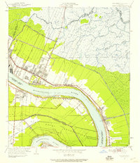
1951 Map of Chalmette
USGS Topo · Published 1958About this map
The Mississippi River defines this landscape below New Orleans, where the river's sharp curve at English Turn dictated early settlement patterns and defensive infrastructure. In the early 1950s, the area reflects a transition from plantation-era geometry to post-war residential expansion, seen in developments like Chalmette Vista and St Claude Heights. The heavy presence of the U S Naval Reservation and the Louisiana Southern railroad underscores the strategic industrial and military importance of the river corridor. Significant commemorative sites, including the Chalmette Nat Mon and Chalmette Nat Cem, mark the ground where the Battle of New Orleans was fought. Beyond the levees, the map reveals a vast network of marshes drained by the Bayou Bienvenue and Bayou Ducros, crisscrossed by drainage canals such as the Fortification Canal.
Find a feature on this map
41 named features on this map. Tap any name to fly to it.
Don’t see what you’re looking for? This feature index may not catch every label — zoom into the map to look around manually.
Map Details
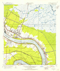
Editions of this 1951 Chalmette Map
2 editions found
Other maps of this area

1891 · Spanish Fort
USGS Topo · 1:62,500

1891 · New Orleans
USGS Topo · 1:62,500

1892 · Chef Menteur
USGS Topo · 1:62,500

1892 · St. Bernard
USGS Topo · 1:62,500

1932 · New Orleans NE
USGS Topo · 1:31,680

1932 · New Orleans SE
USGS Topo · 1:31,680

1935 · Delacroix
USGS Topo · 1:31,680

1936 · Chef Menteur
USGS Topo · 1:62,500

1936 · Spanish Fort
USGS Topo · 1:62,500

1937 · Chef Menteur
USGS Topo · 1:31,680