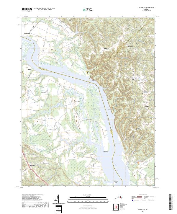
2022 Map of Champlain
USGS Topo · Published 2022About this map
The Rappahannock River dictates the character of this Tidewater landscape, separating Westmoreland Co and Richmond Co from Essex Co. Steep elevations at Fones Cliffs provide a dramatic contrast to the expansive marshlands of Beverly Marsh and Otterburn Marsh. The colonial-era settlement of Leedstown remains a focal point in the northwest, connected to the interior via Leedstown Rd. On the opposite bank, the community of Champlain sits at the intersection of the Tidewater Trl, serving as a gateway to the intricate network of creeks and necks. This region is defined by its deep relationship with the water, where landmarks like Lukes Island and Paynes Island emerge from the river, and inland swamps such as Margaret Lee Swamp and Mud Hole Swamp drain the low-lying timber and farm tracts.
Find a feature on this map
93 named features on this map. Tap any name to fly to it.
Don’t see what you’re looking for? This feature index may not catch every label — zoom into the map to look around manually.
Map Details
Editions of this 2022 Champlain Map
This is the sole edition of this map. No revisions or reprints were ever made.
Other maps of this area

1889 · Fredericksburg
USGS Topo · 1:125,000

1892 · Fredericksburg
USGS Topo · 1:125,000

1892 · Montross
USGS Topo · 1:62,500

1894 · Fredericksburg
USGS Topo · 1:125,000

1895 · Nomini
USGS Topo · 1:125,000

1895 · Montross
USGS Topo · 1:62,500

1898 · Nomini
USGS Topo · 1:125,000

1918 · Tappahannock
USGS Topo · 1:62,500

1918 · Aylett
USGS Topo · 1:62,500

1919 · Tappahannock
USGS Topo · 1:62,500