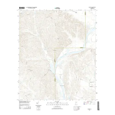
2014 Map of Chance
USGS Topo · Published 2014About this map
The Alabama River and its expansive backwaters dominate this landscape along the border of Clarke and Monroe Counties. The terrain is defined by the winding course of Claiborne Lake, which submerged portions of the river valley and created a complex network of inlets and shoals, including Turkey Shoals and Silver Creek Shoal. Small upland settlements and rural family sites are scattered throughout the hills, connected by a web of local routes such as Fellowship Rd and Silver Creek Rd. Local genealogists will find several family-named landmarks and burial grounds, including Wright Cem, Fellowship Cem, and Williams Cem near Finchburg. The map illustrates the 21st-century character of these riverine communities, where the economy and lifestyle are closely tied to the water at Williams Lake and the various creeks like Maiben Cr that feed into the main channel.
Find a feature on this map
43 named features on this map. Tap any name to fly to it.
Don’t see what you’re looking for? This feature index may not catch every label — zoom into the map to look around manually.
Map Details
Editions of this 2014 Chance Map
This is the sole edition of this map. No revisions or reprints were ever made.
Other maps of this area

1953 · Andalusia
USGS Topo · 1:250,000

1957 · Andalusia
USGS Topo · 1:250,000

1972 · Franklin
USGS Topo · 1:24,000

1972 · Mexia
USGS Topo · 1:24,000

1972 · Whatley
USGS Topo · 1:24,000

1972 · Claiborne
USGS Topo · 1:24,000

1972 · Suggsville
USGS Topo · 1:24,000

1972 · Chance
USGS Topo · 1:24,000

1973 · Fulton East
USGS Topo · 1:24,000

1973 · Hybart
USGS Topo · 1:24,000