
1972 Map of Mexia
USGS Topo · Published 1974About this map
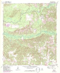
Big Flat Creek and its many meandering tributaries, including Bradley Mill Creek and Holly Mill Cr, dominate the northern drainage of this Monroe County landscape. This early 1970s topography highlights a rural economy defined by timber and transit, with the St Louis-San Francisco railroad cutting north-south through the center of the sheet. Small communities like Fountain, Hixon, and Perdue Hill are connected by a network of light-duty and unimproved roads, while the Hixon Lookout Tower stands as a prominent landmark on the high ground between Limestone Creek and the rail line. To the southeast, the village of Mexia serves as a local hub near the Victoria Ch, illustrating the traditional southern settlement pattern of small church-centered communities and family-named watercourses.
Find a feature on this map
15 named features on this map. Tap any name to fly to it.
Don’t see what you’re looking for? This feature index may not catch every label — zoom into the map to look around manually.
Map Details
Editions of this 1972 Mexia Map
2 editions found
Other maps of this area

1953 · Andalusia
USGS Topo · 1:250,000

1957 · Andalusia
USGS Topo · 1:250,000

1972 · Monroeville
USGS Topo · 1:24,000

1972 · Frisco City
USGS Topo · 1:24,000

1972 · Natchez
USGS Topo · 1:24,000

1972 · Franklin
USGS Topo · 1:24,000

1972 · Excel
USGS Topo · 1:24,000

1972 · Flynns Lake
USGS Topo · 1:24,000

1972 · Claiborne
USGS Topo · 1:24,000

1972 · Chance
USGS Topo · 1:24,000