
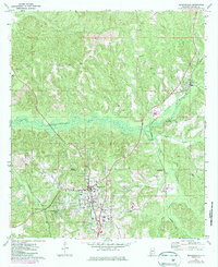
1972 Map of Monroeville
USGS Topo · Published 1973About this map
Monroeville serves as the focal point of this southwestern Alabama landscape, showing the city's mid-century footprint alongside its industrial and transit infrastructure. The Louisville and Nashville railroad cuts through the eastern terrain near Peterman, while the St Louis San Francisco line serves the western reaches. Rural life remains centered on community landmarks like Mt Olive Ch, Antioch Ch, and Mars Hill Ch, while smaller settlements such as Axle and The Ridge are positioned along the highland elevations. The topography is defined by the significant drainage of Limestone Creek, which is monitored by a Gaging Station to the west. This map provides a detailed view of the area's development during the early 1970s, including the growth of West Monroeville and the presence of localized features like Vanity Fair Lake and Monroeton.
Find a feature on this map
27 named features on this map. Tap any name to fly to it.
Don’t see what you’re looking for? This feature index may not catch every label — zoom into the map to look around manually.
Map Details
Editions of this 1972 Monroeville Map
2 editions found
Other maps of this area

1953 · Andalusia
USGS Topo · 1:250,000

1957 · Andalusia
USGS Topo · 1:250,000

1967 · Beatrice
USGS Topo · 1:24,000

1971 · Burnt Corn
USGS Topo · 1:24,000

1971 · Repton
USGS Topo · 1:24,000

1971 · Beatrice
USGS Topo · 1:24,000

1972 · Frisco City
USGS Topo · 1:24,000

1972 · Natchez
USGS Topo · 1:24,000

1972 · Franklin
USGS Topo · 1:24,000

1972 · Excel
USGS Topo · 1:24,000