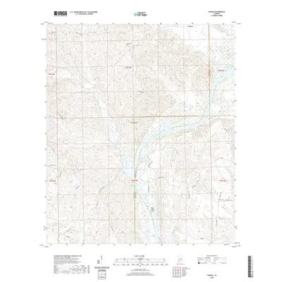
2020 Map of Chance
USGS Topo · Published 2020About this map
The Alabama River meanders through the heart of this landscape along the border of Clarke and Monroe Counties, creating a complex hydrologic network of creeks and backwaters. In this rural stretch of southwest Alabama, the small community of Chance sits north of the river, while the terrain is marked by distinctive riverine features such as Turkey Shoals and Silver Creek Shoal. The map reveals a dispersed settlement pattern typical of the region's timber and agricultural lands, connected by narrow corridors like Maiben Lake Rd and Silver Creek Rd.
Find a feature on this map
42 named features on this map. Tap any name to fly to it.
Don’t see what you’re looking for? This feature index may not catch every label — zoom into the map to look around manually.
Map Details
Editions of this 2020 Chance Map
This is the sole edition of this map. No revisions or reprints were ever made.
Other maps of this area

1953 · Andalusia
USGS Topo · 1:250,000

1957 · Andalusia
USGS Topo · 1:250,000

1972 · Franklin
USGS Topo · 1:24,000

1972 · Mexia
USGS Topo · 1:24,000

1972 · Whatley
USGS Topo · 1:24,000

1972 · Claiborne
USGS Topo · 1:24,000

1972 · Suggsville
USGS Topo · 1:24,000

1972 · Chance
USGS Topo · 1:24,000

1973 · Fulton East
USGS Topo · 1:24,000

1973 · Hybart
USGS Topo · 1:24,000