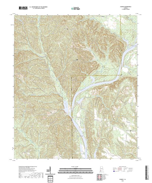
2024 Map of Chance
USGS Topo · Published 2024About this map
The Alabama River carves a deep, winding path through this corner of Southwest Alabama, defining the border between Clarke Co and Monroe Co. The landscape is dominated by river-fed hydrology, featuring significant navigational markers like Turkey Shoals and Silver Creek Shoal, alongside landforms such as Haines Island. Small family and community landmarks are scattered across the wooded ridges, including Wright Cem, Fellowship Cem, and Williams Cem. The small settlement of Chance sits in the northern reaches, connected to the surrounding countryside by a network of rural routes like Silver Creek Rd and Finchburg Rd. Numerous tributaries, including Mill Creek, Maiben Creek, and Little Silver Creek, cut through the terrain to join the main river channel, illustrating a classic Gulf Coastal Plain drainage pattern.
Find a feature on this map
45 named features on this map. Tap any name to fly to it.
Don’t see what you’re looking for? This feature index may not catch every label — zoom into the map to look around manually.
Map Details
Editions of this 2024 Chance Map
This is the sole edition of this map. No revisions or reprints were ever made.
Other maps of this area

1953 · Andalusia
USGS Topo · 1:250,000

1957 · Andalusia
USGS Topo · 1:250,000

1972 · Franklin
USGS Topo · 1:24,000

1972 · Mexia
USGS Topo · 1:24,000

1972 · Whatley
USGS Topo · 1:24,000

1972 · Claiborne
USGS Topo · 1:24,000

1972 · Suggsville
USGS Topo · 1:24,000

1972 · Chance
USGS Topo · 1:24,000

1973 · Fulton East
USGS Topo · 1:24,000

1973 · Hybart
USGS Topo · 1:24,000