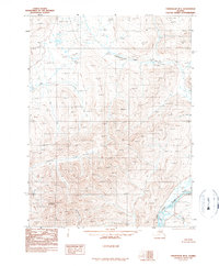
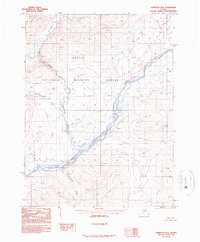
1990 Map of Chandalar B-1
USGS Topo · Published 1990About this map
Dhazik Mountain rises as the prominent high point in this 1990 provisional study, anchoring a landscape defined by an intricate network of drainage basins. The East Fork Chandalar River cuts through the southeastern corner, where it is joined by the winding Crater Creek. This interior Alaskan terrain is marked by significant elevation changes, from the low-lying marshy area simply labeled Flat to the steep ridges overlooking Chekhechunnjik Creek and Funchion Creek. The drainage patterns, including Zimmerman Creek and Coal River, illustrate the complex hydrology of the Yukon-Koyukuk region before any modern infrastructure or road networks were established. This map was compiled from aerial photography taken in the early 1980s, providing a precise record of the natural topography and unnamed peaks that characterize this part of the Chandalar quadrangle.
Find a feature on this map
8 named features on this map. Tap any name to fly to it.
Don’t see what you’re looking for? This feature index may not catch every label — zoom into the map to look around manually.
Map Details
Editions of this 1990 Chandalar B-1 Map
This is the sole edition of this map. No revisions or reprints were ever made.
Other maps of this area

1951 · Chandalar
USGS Topo · 1:250,000

1951 · Christian
USGS Topo · 1:250,000

1956 · Chandalar
USGS Topo · 1:250,000

1956 · Christian
USGS Topo · 1:250,000

1964 · Chandalar
USGS Topo · 1:250,000
1990 · Chandalar A-2
USGS Topo · 1:63,360
1990 · Chandalar A-1
USGS Topo · 1:63,360
1990 · Christian C-6
USGS Topo · 1:63,360

1990 · Chandalar C-2
USGS Topo · 1:63,360
1990 · Christian B-6
USGS Topo · 1:63,360