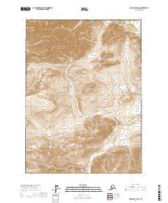
2017 Map of Chandalar D-1 NE
USGS Topo · Published 2017About this map
The Yukon-Koyukuk Census Area is defined by its dramatic elevation changes and intricate drainage patterns in this northern interior region of Alaska. The landscape is characterized by steep ridges and deep valleys, organized by the Public Land Survey System into townships such as T37n R2e and T36n R3e. This 2017 survey reveals a wilderness devoid of modern roads or named settlements, highlighting the region's enduring character as an undeveloped frontier where natural topography dictates the movement of water and any seasonal passage through the terrain. The contour lines indicate significant vertical relief, providing a clear picture of the landforms within T35n R2e and surrounding sections.
Find a feature on this map
7 named features on this map. Tap any name to fly to it.
Don’t see what you’re looking for? This feature index may not catch every label — zoom into the map to look around manually.
Map Details
Editions of this 2017 Chandalar D-1 NE Map
This is the sole edition of this map. No revisions or reprints were ever made.
Other maps of this area

1951 · Chandalar
USGS Topo · 1:250,000

1951 · Christian
USGS Topo · 1:250,000

1951 · Brooks
USGS Topo · 1:250,000

1951 · Arctic
USGS Topo · 1:250,000

1956 · Arctic
USGS Topo · 1:250,000

1956 · Chandalar
USGS Topo · 1:250,000

1956 · Philip Smith Mountains
USGS Topo · 1:250,000

1956 · Christian
USGS Topo · 1:250,000

1964 · Chandalar
USGS Topo · 1:250,000

1964 · Philip Smith Mountains
USGS Topo · 1:250,000