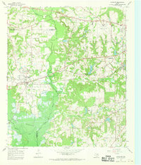
1966 Map of Chandler
USGS Topo · Published 1969About this map
The St Louis Southwestern railroad corridor defines the development of the Chandler area, cutting through the landscape just north of where the Neches River feeds into Lake Palestine. This 1960s survey documents a landscape defined by small rural congregations and family burial grounds, such as Concord Ch and Sevenleague Cem. The northern reach of the sheet is marked by the aviation infrastructure of Pounds Field, while the southern half transitions into the low-lying wetlands of the Neches valley. The intricate network of small water bodies, including Cade Lake and Lake Placid, illustrates the region's complex drainage pattern before further mid-century development. Genealogists can trace localized settlements like Galilee and find preserved sites like the Pleasant Retreat Cem, which speak to the area's deep-rooted community history at the borders of Henderson and Smith counties.
Find a feature on this map
37 named features on this map. Tap any name to fly to it.
Don’t see what you’re looking for? This feature index may not catch every label — zoom into the map to look around manually.
Map Details
Editions of this 1966 Chandler Map
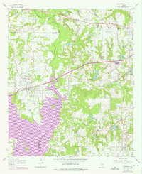
Other maps of this area

1946 · Bullard
USGS Topo · 1:62,500

1948 · Bullard
USGS Topo · 1:62,500

1948 · Tyler
USGS Topo · 1:62,500

1948 · Brownsboro
USGS Topo · 1:62,500

1949 · Tyler
USGS Topo · 1:62,500

1949 · Brownsboro
USGS Topo · 1:62,500

1949 · Frankston
USGS Topo · 1:62,500

1950 · Frankston
USGS Topo · 1:62,500

1956 · Tyler
USGS Topo · 1:250,000

1966 · Chandler
USGS Topo · 1:24,000