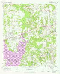
1966 Map of Chandler
USGS Topo · Published 1976About this map
Lake Palestine dominates the southwestern corner of this survey, where the Neches River valley gives way to the expansive waters that bridge the Henderson Co and Smith Co border. Near the center of the sheet, the town of Chandler is anchored by the St Louis Southwestern railroad, showing the community's mid-century layout alongside local landmarks like the Macedonia Cem. The landscape to the east is defined by numerous small water bodies and drainage basins, including Lost Pine Lake and Lake Placid, interspersed with country churches such as Dean Ch and Spring Hill Ch.
Find a feature on this map
32 named features on this map. Tap any name to fly to it.
Don’t see what you’re looking for? This feature index may not catch every label — zoom into the map to look around manually.
Map Details
Editions of this 1966 Chandler Map
Other maps of this area

1946 · Bullard
USGS Topo · 1:62,500

1948 · Bullard
USGS Topo · 1:62,500

1948 · Tyler
USGS Topo · 1:62,500

1948 · Brownsboro
USGS Topo · 1:62,500

1949 · Tyler
USGS Topo · 1:62,500

1949 · Brownsboro
USGS Topo · 1:62,500

1949 · Frankston
USGS Topo · 1:62,500

1950 · Frankston
USGS Topo · 1:62,500

1956 · Tyler
USGS Topo · 1:250,000

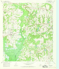
1966 · Chandler
USGS Topo · 1:24,000