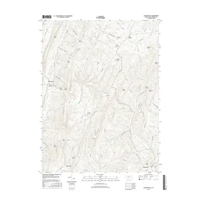
2016 Map of Chaneysville
USGS Topo · Published 2016About this map
Chaneysville and its surrounding mountain ridges define this portion of Bedford County, where small rural settlements are linked by a complex network of forest roads and creek-side trails. The landscape is characterized by a series of parallel heights including Warrior Ridge, Polish Mtn, and Big Mtn, with narrow hollows like Three Lick Hollow and Buttermilk Hollow tucked between them. This topographic survey captures the enduring rural character of the area, punctuated by numerous historic congregational sites and family burial grounds such as the Ash-Snyder Cem and Barkman Cem. The presence of the Ragged Mountain Airport near the El - Bethel Assembly of God indicates the intersection of modern utility with traditional mountain life. Waterways such as Sweet Root Cr and Town Cr drain the valleys, providing a geographical focus for the small clusters of homes at Elbinsville and Five Forks.
Find a feature on this map
95 named features on this map. Tap any name to fly to it.
Don’t see what you’re looking for? This feature index may not catch every label — zoom into the map to look around manually.
Map Details
Editions of this 2016 Chaneysville Map
This is the sole edition of this map. No revisions or reprints were ever made.
Other maps of this area

1898 · Paw Paw
USGS Topo · 1:62,500

1899 · Flintstone
USGS Topo · 1:62,500

1900 · Pawpaw
USGS Topo · 1:62,500

1900 · Flintstone
USGS Topo · 1:62,500

1910 · Paw Paw
USGS Topo · 1:62,500

1927 · Clearville
USGS Topo · 1:48,000

1927 · Hyndman
USGS Topo · 1:62,500

1931 · Clearville
USGS Topo · 1:62,500

1931 · Hyndman
USGS Topo · 1:62,500

1944 · Hyndman
USGS Topo · 1:62,500
Featured Places
- Mann Township, PA
- Southampton Township, PA
- Monroe Township, PA
- Inglesmith, Mann Township
- Chaneysville, Southampton Township