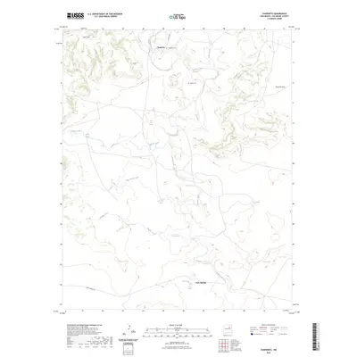
2023 Map of Chaperito
USGS Topo · Published 2023About this map
The Gallinas River carves a winding path through this corner of San Miguel County, anchoring the small settlements and seasonal grazing lands of the high plains. The historic community of Chaperito sits in the northern reaches of the quadrangle, accompanied by the Chaperito Cem, while further south the terrain opens toward Park Springs. This landscape is defined by its water sources and mesa topography, with prominent landforms like East Mesa and Mesa Montosa overlooking a network of drainages including Aguilar Creek and Pamilla Creek. Local history is etched into the map through numerous named springs such as Ojo de la Gallina, Agua Azul Spring, and Salitre Spring, which likely served as vital hubs for early ranching and transit. Two burial grounds, including the Aguila Cem, provide tangible links for genealogists tracing families in this arid river valley region.
Find a feature on this map
21 named features on this map. Tap any name to fly to it.
Don’t see what you’re looking for? This feature index may not catch every label — zoom into the map to look around manually.
Map Details
Editions of this 2023 Chaperito Map
This is the sole edition of this map. No revisions or reprints were ever made.
Other maps of this area

1890 · Bernal
USGS Topo · 1:125,000

1891 · Bernal
USGS Topo · 1:125,000

1892 · Corazon
USGS Topo · 1:125,000

1894 · Corazon
USGS Topo · 1:125,000

1894 · Bernal
USGS Topo · 1:125,000

1954 · Santa Fe
USGS Topo · 1:250,000

1958 · Santa Fe
USGS Topo · 1:250,000

1960 · Apache Springs
USGS Topo · 1:62,500

1963 · Pedro Miguel Peak
USGS Topo · 1:24,000

1963 · Cactus Tank
USGS Topo · 1:24,000