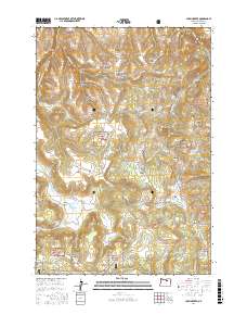
2017 Map of Chapin Creek
USGS Topo · Published 2017About this map
Camas Prairie defines the central lower portion of this landscape, its wetland character contrasting with the surrounding complex of ridges and canyons. This 2017 survey details a portion of the Umatilla National Forest where several prominent buttes, including Camas Butte and Shingle Mill Butte, rise above a network of named flats and meadows. The transport network consists primarily of forest roads and trails, such as Camas Prairie Rd, Kinzua Rd, and Rankin Ln, providing access to high-elevation features like Burton Hill and Lava Flat. Natural water sources are scarce, marked by isolated springs such as Hasting Spring and Miller Spring that would have been vital for early livestock grazing and forestry operations in this part of Morrow County. Numerous deep-cut canyons, including McCarty Canyon and Buck Canyon, illustrate the erosional patterns of the local watershed feeding into Chapin Creek.
Find a feature on this map
63 named features on this map. Tap any name to fly to it.
Don’t see what you’re looking for? This feature index may not catch every label — zoom into the map to look around manually.
Map Details
Editions of this 2017 Chapin Creek Map
This is the sole edition of this map. No revisions or reprints were ever made.
Other maps of this area
1953 · Kimberly
USGS Topo · 1:62,500
1953 · Spray
USGS Topo · 1:62,500

1953 · Pendleton
USGS Topo · 1:250,000

1955 · Canyon City
USGS Topo · 1:250,000

1956 · Pendleton
USGS Topo · 1:250,000

1959 · Canyon City
USGS Topo · 1:250,000
1969 · Lefevre Prairie
USGS Topo · 1:24,000
1969 · Buttermilk Canyon
USGS Topo · 1:24,000
1969 · Chapin Creek
USGS Topo · 1:24,000
1969 · Hardman
USGS Topo · 1:24,000