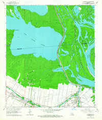
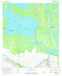
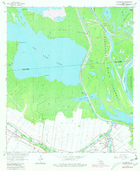
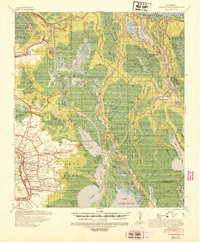
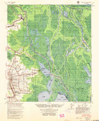
1963 Map of Charenton
USGS Topo · Published 1964About this map
Bayou Teche defines the southern portion of this landscape, where the settlements of Charenton, Matilda, and Sorrel are clustered along its banks in the early 1960s. This area represents a transition from established agricultural and residential corridors to the expansive wetlands of the Atchafalaya Basin Floodway. The transport of the era is marked by the Southern Pacific railroad line and the critical Charenton Drainage and Navigation Canal, which cuts through the swamp to connect the bayou to the basin waters.
Find a feature on this map
36 named features on this map. Tap any name to fly to it.
Don’t see what you’re looking for? This feature index may not catch every label — zoom into the map to look around manually.
Map Details
Editions of this 1963 Charenton Map
3 editions found
Other maps of this area

1935 · Chicot Lake
USGS Topo · 1:62,500

1937 · Jeanerette
USGS Topo · 1:62,500
1941 · Loreauville
USGS Topo · 1:62,500

1945 · New Orleans
USGS Topo · 1:250,000

1948 · Foster
USGS Topo · 1:62,500

1954 · Chicot Lake
USGS Topo · 1:62,500
1954 · Loreauville
USGS Topo · 1:62,500
1954 · Jeanerette
USGS Topo · 1:62,500

1954 · Baton Rouge
USGS Topo · 1:250,000

1955 · Chicot Lake
USGS Topo · 1:62,500