
Historical Maps of St. Mary County, Louisiana
Journey back in time with 144 historical maps of St. Mary County, dating from 1932 to present day. Explore and discover the history of St. Mary County through detailed topographic maps, featuring cities, landmarks, and geographical changes. Dive deeper into each map with our interactive high-resolution viewer and extensive library data. Every map in our collection is also available for purchase as a framed or unframed museum-quality print for those interested interested in bringing a part of history into their home. Begin your historical adventure now!
St. Mary County, LA maps (144)
- 1932 Map of Lake Decade
 1932 Lake Decade1932 Print · USGSCovers portions of St. Mary County, including Terrebonne County, and others.
 - 1935 Map of Morgan City
 1935 Morgan City1935 Print · USGSCovers portions of St. Mary County, including Morgan City, Terrebonne County, Lafourche County, and others.
 - 1937 Map of Bayou Sale, 1949 Print
 1937 Bayou Sale1949 Print · USGSCovers portions of St. Mary County, including Iberia County, and others.
 - 1937 Map of Derouen, 1963 Print
 1937 Derouen1963 Print · USGSCovers portions of St. Mary County, including Iberia County, Vermilion County, and others.
 - 1937 Map of Jeanerette, 1949 Print
 1937 Jeanerette1949 Print · USGSCovers portions of St. Mary County, including Jeanerette, and others.
 - 1941 Map of Belle Isle, 1943 Print
 1941 Belle Isle1943 Print · USGSCovers portions of St. Mary County, including Terrebonne County, and others.
 - 1945 Map of New Orleans
 1945 New Orleans1945 Print · USGSCovers portions of St. Mary County, including New Orleans, St. Bernard County, and others.
 - 1948 Map of Cypremort Point, 1952 Print
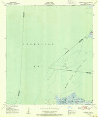 1948 Cypremort Point1952 Print · USGSCovers portions of St. Mary County, including Iberia County, Vermilion County, and others.
 - 1948 Map of Cypremort Point, 1964 Print
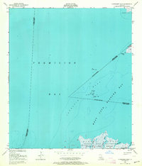 1948 Cypremort Point1964 Print · USGSCovers portions of St. Mary County, including Iberia County, Vermilion County, and others.

Showing maps 1-10 of 144
Explore maps of related cities
See more
Explore maps of related counties
- Acadia County, LA
- Allen County, LA
- Ascension County, LA
- Assumption County, LA
- Avoyelles County, LA
- Beauregard County, LA
See more
Frequently asked questions
- Can I purchase a physical print of a historical map of St. Mary County, LA?
- Why are historical maps of St. Mary County, LA important for research and professional purposes?
- What types of historical maps are available for St. Mary County, LA?
- What advanced features do you offer for professional use?
- How can I find a specific historical map of St. Mary County, LA?
- How can I contribute a historical map of St. Mary County, LA that's not in your collection?
- What is the oldest map of St. Mary County, LA in your collection?
- How can I download a map of St. Mary County, LA?