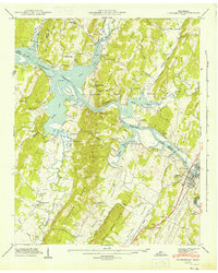
1943 Map of Charleston
USGS Topo · Published 1946About this map
The Hiwassee River and the expansive Chickamauga Reservoir dominate this landscape, where the borders of Meigs, McMinn, and Bradley counties meet. The twin settlements of Charleston and Calhoun flank the river at the eastern edge of the survey, connected by the Southern railroad line and Highway 11. This area preserves a network of rural community centers, including Lamontville and Eureka, alongside numerous country sanctuaries like Blevins Chapel and Shelton Memorial Chapel. The topography is defined by parallel ridges such as Mc Minn Ridge and Rogers Creek Ridge, which separate fertile corridors like Walker Valley and Dry Valley. Significant land tracts are marked by the Reservation Boundary, indicating the wide-reaching impact of the Tennessee Valley Authority's hydraulic projects on the local geography during the early 1940s.
Find a feature on this map
53 named features on this map. Tap any name to fly to it.
Don’t see what you’re looking for? This feature index may not catch every label — zoom into the map to look around manually.
Map Details
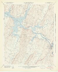
Editions of this 1943 Charleston Map
2 editions found
Other maps of this area

1886 · Cleveland
USGS Topo · 1:125,000

1892 · Cleveland
USGS Topo · 1:125,000

1895 · Cleveland
USGS Topo · 1:125,000

1901 · Cleveland
USGS Topo · 1:125,000

1935 · East Cleveland
USGS Topo · 1:24,000

1935 · Calhoun
USGS Topo · 1:24,000

1935 · Benton
USGS Topo · 1:24,000

1935 · Goodfield
USGS Topo · 1:24,000

1935 · Charleston
USGS Topo · 1:24,000
1935 · Birchwood
USGS Topo · 1:24,000