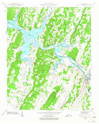
1942 Map of Charleston
USGS Topo · Published 1965About this map
Chickamauga Lake and the Hiwassee River define the local geography where the borders of Meigs, McMinn, and Bradley counties meet. This 1940s landscape is characterized by prominent northeast-trending ridges, including the Meigs McMinn Ridge and Candies Creek Ridge, which separate fertile valleys like Walker Valley and Dry Valley. The settlement of Charleston and the adjacent town of Calhoun serve as focal points along the Southern railroad line, representing the established river-and-rail corridor of the era.
Find a feature on this map
46 named features on this map. Tap any name to fly to it.
Don’t see what you’re looking for? This feature index may not catch every label — zoom into the map to look around manually.
Map Details
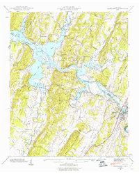
Editions of this 1942 Charleston Map
2 editions found
Other maps of this area

1886 · Cleveland
USGS Topo · 1:125,000

1892 · Cleveland
USGS Topo · 1:125,000

1895 · Cleveland
USGS Topo · 1:125,000

1901 · Cleveland
USGS Topo · 1:125,000

1935 · East Cleveland
USGS Topo · 1:24,000

1935 · Calhoun
USGS Topo · 1:24,000

1935 · Benton
USGS Topo · 1:24,000

1935 · Goodfield
USGS Topo · 1:24,000

1935 · Charleston
USGS Topo · 1:24,000
1935 · Birchwood
USGS Topo · 1:24,000