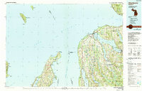
1984 Map of Charlevoix
USGS Topo · Published 1990About this map
Lake Michigan dominates this coastal landscape, surrounding the scattered islands of the Beaver Islands State Wildlife Research Area and the isolated South Fox Island Lighthouse. The shoreline of the northern Lower Peninsula is defined by its deep bays and glacial lakes, notably the expansive Lake Charlevoix with its South Arm, and the long, narrow Lake Leelanau. Local hubs like Charlevoix and Boyne City serve as anchors for the region, while smaller communities such as Ironton, Peshawbestown, and Omena reflect the enduring settlement patterns of the Leelanau and Antrim county coasts.
Find a feature on this map
104 named features on this map. Tap any name to fly to it.
Don’t see what you’re looking for? This feature index may not catch every label — zoom into the map to look around manually.
Map Details
Editions of this 1984 Charlevoix Map
2 editions found

Other maps of this area

1954 · Central Lake
USGS Topo · 1:62,500

1954 · Charlevoix
USGS Topo · 1:62,500

1954 · Traverse City
USGS Topo · 1:250,000

1954 · Escanaba
USGS Topo · 1:250,000

1954 · Manitowoc
USGS Topo · 1:250,000

1955 · Gull Island
USGS Topo · 1:62,500

1955 · Cheboygan
USGS Topo · 1:250,000

1956 · Alba
USGS Topo · 1:62,500

1956 · Mancelona
USGS Topo · 1:62,500

1956 · North Manitou
USGS Topo · 1:62,500