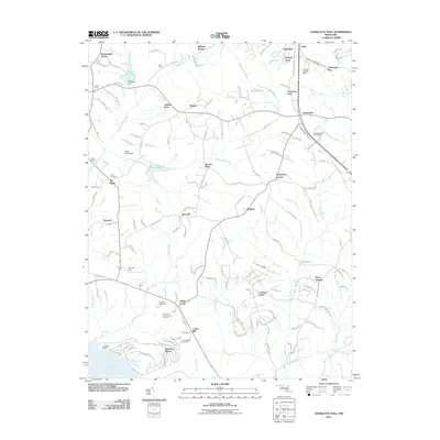
2011 Map of Charlotte Hall
USGS Topo · Published 2011About this map
The Charlotte Hall Post Office area anchors this 2011 survey, showing a landscape defined by residential growth and significant recreation venues. The southern portion of the quadrangle highlights the Maryland International Raceway and Potomac Speedway, indicating a hub for regional automotive sports. Water features including Chaptico Creek, Killpeck Creek, and the Wicomico River drain the terrain, with many smaller branches named for local landmarks like Coffee Hill Run and Smoots Pond Run.
Find a feature on this map
160 named features on this map. Tap any name to fly to it.
Don’t see what you’re looking for? This feature index may not catch every label — zoom into the map to look around manually.
Map Details
Editions of this 2011 Charlotte Hall Map
This is the sole edition of this map. No revisions or reprints were ever made.
Other maps of this area

1892 · Leonardtown
USGS Topo · 1:62,500

1892 · Prince Frederick
USGS Topo · 1:62,500

1892 · Brandywine
USGS Topo · 1:62,500

1894 · Wicomico
USGS Topo · 1:62,500

1895 · Prince Frederick
USGS Topo · 1:62,500

1895 · Wicomico
USGS Topo · 1:62,500

1895 · Brandywine
USGS Topo · 1:62,500

1895 · Leonardtown
USGS Topo · 1:62,500

1895 · Nomini
USGS Topo · 1:125,000

1898 · Nomini
USGS Topo · 1:125,000