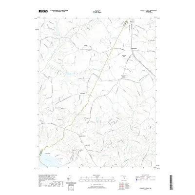
2019 Map of Charlotte Hall
USGS Topo · Published 2019About this map
Charlotte Hall serves as a central hub in this Southern Maryland landscape, where the boundary between Charles and St. Mary's counties follows the intricate drainage of Gilbert Swamp Run. The map documents a rural corridor transitioning between agricultural roots and preservation, notably marked by the Potomac Heritage National Scenic Trail as it winds through Thompson Corner and Ryceville. To the south, the terrain descends toward the Wicomico River at Luckton Point, fed by numerous named tributaries like Budds Creek and Indiantown Run. Local heritage is anchored by significant sites such as the Trinity Church Cemetery and John Wesley Cemetery, while smaller settlements like Newmarket and Coffee Hill illustrate the historic distribution of crossroads communities. The presence of Trinity Lake and various "ponds" and "runs" highlights the water-rich geography that has long shaped the region's development.
Find a feature on this map
39 named features on this map. Tap any name to fly to it.
Don’t see what you’re looking for? This feature index may not catch every label — zoom into the map to look around manually.
Map Details
Editions of this 2019 Charlotte Hall Map
This is the sole edition of this map. No revisions or reprints were ever made.
Other maps of this area

1892 · Leonardtown
USGS Topo · 1:62,500

1892 · Prince Frederick
USGS Topo · 1:62,500

1892 · Brandywine
USGS Topo · 1:62,500

1894 · Wicomico
USGS Topo · 1:62,500

1895 · Prince Frederick
USGS Topo · 1:62,500

1895 · Wicomico
USGS Topo · 1:62,500

1895 · Brandywine
USGS Topo · 1:62,500

1895 · Leonardtown
USGS Topo · 1:62,500

1895 · Nomini
USGS Topo · 1:125,000

1898 · Nomini
USGS Topo · 1:125,000