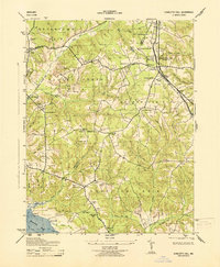
1943 Map of Charlotte Hall
USGS Topo · Published 1943About this map
The Charlotte Hall Military Academy stands as a prominent fixture in this Southern Maryland landscape during the Second World War. Centered around the settlement of Charlotte Hall, the terrain transitions from the educational and religious hubs of Newmarket and Oaks toward the tidal reaches of the Wicomico River. The map reveals a dense network of local schools and churches, such as the White Marsh School, St Pauls Ch, and Bethel Ch, which served the rural communities of Mechanicsville and Chaptico.
Find a feature on this map
55 named features on this map. Tap any name to fly to it.
Don’t see what you’re looking for? This feature index may not catch every label — zoom into the map to look around manually.
Map Details
Editions of this 1943 Charlotte Hall Map
This is the sole edition of this map. No revisions or reprints were ever made.
Other maps of this area

1892 · Leonardtown
USGS Topo · 1:62,500

1892 · Prince Frederick
USGS Topo · 1:62,500

1892 · Brandywine
USGS Topo · 1:62,500

1894 · Wicomico
USGS Topo · 1:62,500

1895 · Prince Frederick
USGS Topo · 1:62,500

1895 · Wicomico
USGS Topo · 1:62,500

1895 · Brandywine
USGS Topo · 1:62,500

1895 · Leonardtown
USGS Topo · 1:62,500

1895 · Nomini
USGS Topo · 1:125,000

1898 · Nomini
USGS Topo · 1:125,000