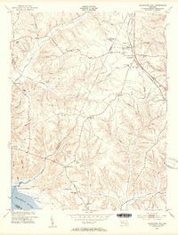
1953 Map of Charlotte Hall
USGS Topo · Published 1954About this map
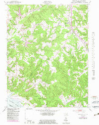
The Charlotte Hall Military Academy serves as a prominent landmark in the north, anchoring a region where the boundary between Charles and St. Mary's counties follows the winding course of Gilbert Run. The landscape is defined by the transition from upland ridges to the wide marshes of the Wicomico River in the southwest, with small agricultural communities and rural crossroads connected by a network of local schools and churches.
Find a feature on this map
53 named features on this map. Tap any name to fly to it.
Don’t see what you’re looking for? This feature index may not catch every label — zoom into the map to look around manually.
Map Details
Editions of this 1953 Charlotte Hall Map
5 editions found
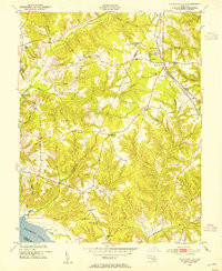
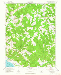
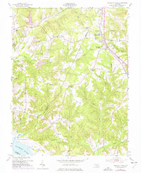
Other maps of this area

1892 · Leonardtown
USGS Topo · 1:62,500

1892 · Prince Frederick
USGS Topo · 1:62,500

1892 · Brandywine
USGS Topo · 1:62,500

1894 · Wicomico
USGS Topo · 1:62,500

1895 · Prince Frederick
USGS Topo · 1:62,500

1895 · Wicomico
USGS Topo · 1:62,500

1895 · Brandywine
USGS Topo · 1:62,500

1895 · Leonardtown
USGS Topo · 1:62,500

1895 · Nomini
USGS Topo · 1:125,000

1898 · Nomini
USGS Topo · 1:125,000