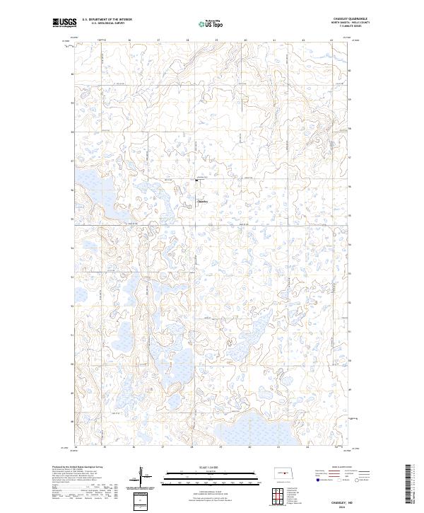
2024 Map of Chaseley
USGS Topo · Published 2024About this map
Chaseley sits at the heart of this Wells County landscape, a concentrated point of settlement amidst a vast network of prairie wetlands. The surrounding terrain is defined by the numerous small ponds and sloughs that characterize the Wells County Waterfowl Production Area, which spans several sections of the township. A rigid grid of section-line roads, including Main St and 32nd Ave NE, provides the primary structure for travel and land division. To the north of the town site, the Chaseley Cem serves as a significant genealogical landmark for the community. The map illustrates a contemporary pattern of land management where agriculture and conservation coexist, with the waterfowl production areas preserved amidst the surveyed parcels of the North Dakota prairie.
Find a feature on this map
25 named features on this map. Tap any name to fly to it.
Don’t see what you’re looking for? This feature index may not catch every label — zoom into the map to look around manually.
Map Details
Editions of this 2024 Chaseley Map
This is the sole edition of this map. No revisions or reprints were ever made.
Other maps of this area

1945 · Manfred
USGS Topo · 1:62,500

1948 · Fessenden
USGS Topo · 1:62,500

1948 · Manfred
USGS Topo · 1:62,500

1949 · Fessenden SW
USGS Topo · 1:24,000

1949 · Manfred SW
USGS Topo · 1:24,000

1950 · Manfred SE
USGS Topo · 1:24,000

1950 · Manfred SW
USGS Topo · 1:24,000

1951 · Bowdon
USGS Topo · 1:24,000

1952 · New Rockford
USGS Topo · 1:250,000

1956 · New Rockford
USGS Topo · 1:250,000