
1888 Map of Chatham
USGS Topo · Published 1888About this map
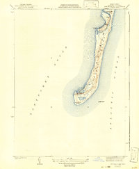
The maritime landscape of the lower Cape is defined by the shifting sands of Nauset Beach and the narrow reach of Monomoy Island in this late 19th-century survey. Focusing on Chatham and Orleans, the map highlights a world shaped by the sea, where critical navigational aids like Chatham Lights and the Monomoy Point Light House guide mariners past treacherous shoals. The interior reveals a complex network of coastal inlets and ponds, including Oyster Pond and Mill Pond, which provided the foundations for the area's early economy.
Find a feature on this map
34 named features on this map. Tap any name to fly to it.
Don’t see what you’re looking for? This feature index may not catch every label — zoom into the map to look around manually.
Map Details
Editions of this 1888 Chatham Map
This is the sole edition of this map. No revisions or reprints were ever made.
Other maps of this area

1887 · Wellfleet
USGS Topo · 1:62,500

1887 · Yarmouth
USGS Topo · 1:62,500

1889 · Yarmouth
USGS Topo · 1:62,500

1889 · Wellfleet
USGS Topo · 1:62,500

1893 · Chatham
USGS Topo · 1:62,500

1893 · Yarmouth
USGS Topo · 1:62,500

1893 · Wellfleet
USGS Topo · 1:62,500

1917 · Chatham
USGS Topo · 1:62,500

1942 · Cape Cod Bay
USGS Topo · 1:125,000
1942 · Monomoy Point
USGS Topo · 1:31,680