
1917 Map of Chatham
USGS Topo · Published 1917About this map
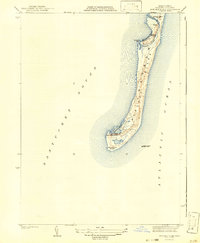
Monomoy Island stretches southward into the Atlantic Ocean in this coastal study revised by the Massachusetts Commission on Waterways and Public Lands. The geography is defined by its maritime infrastructure, featuring the Monomoy Point Light House, Chatham Lights, and Harding Beach Light, alongside anchored vessels like the Pollock Rip Light Ship. The mainland settlements of Chatham, North Chatham, and Chatham Port are clustered around intricate waterways such as Pleasant Bay, Chatham Harbor, and Stage Harbor. The terrestrial landscape includes Nickersons Neck and Nauset Beach, providing a view of the Cape's eastern elbow before modern coastal erosion and sediment shifts significantly altered these landforms. Transportation is anchored by the Chatham Br. railroad line, terminating at a Sta. near the village center.
Find a feature on this map
38 named features on this map. Tap any name to fly to it.
Don’t see what you’re looking for? This feature index may not catch every label — zoom into the map to look around manually.
Map Details
Editions of this 1917 Chatham Map
This is the sole edition of this map. No revisions or reprints were ever made.
Other maps of this area

1887 · Wellfleet
USGS Topo · 1:62,500

1887 · Yarmouth
USGS Topo · 1:62,500

1888 · Chatham
USGS Topo · 1:62,500

1889 · Yarmouth
USGS Topo · 1:62,500

1889 · Wellfleet
USGS Topo · 1:62,500

1893 · Chatham
USGS Topo · 1:62,500

1893 · Yarmouth
USGS Topo · 1:62,500

1893 · Wellfleet
USGS Topo · 1:62,500

1942 · Cape Cod Bay
USGS Topo · 1:125,000
1942 · Monomoy Point
USGS Topo · 1:31,680