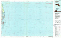
1986 Map of Chatham
USGS Topo · Published 1986About this map
Cape Cod National Seashore dominates this 1980s planimetric study, which illustrates the dynamic outer coastline of the lower cape. The map emphasizes the shifting barrier beach systems, notably the long stretch of Nauset Beach and the isolated sanctuary of Monomoy Island extending into Nantucket Sound. Unlike topographic maps focused on elevation, this planimetric survey provides a clear view of water bodies like Pleasant Bay, Town Cove, and the various harbor inlets from Chatham Port to Stage Harbor.
Find a feature on this map
49 named features on this map. Tap any name to fly to it.
Don’t see what you’re looking for? This feature index may not catch every label — zoom into the map to look around manually.
Map Details
Editions of this 1986 Chatham Map
This is the sole edition of this map. No revisions or reprints were ever made.
Other maps of this area

1887 · Wellfleet
USGS Topo · 1:62,500

1887 · Yarmouth
USGS Topo · 1:62,500

1887 · Provincetown
USGS Topo · 1:62,500

1888 · Chatham
USGS Topo · 1:62,500

1889 · Yarmouth
USGS Topo · 1:62,500

1889 · Provincetown
USGS Topo · 1:62,500

1889 · Wellfleet
USGS Topo · 1:62,500

1893 · Chatham
USGS Topo · 1:62,500

1893 · Yarmouth
USGS Topo · 1:62,500

1893 · Wellfleet
USGS Topo · 1:62,500