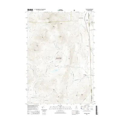
2015 Map of Chatham
USGS Topo · Published 2015About this map
White Mountain National Forest dominates this section of the New Hampshire and Maine border, where the rugged peaks of the White Mountains rise between the drainages of the Wild River and the Cold River. The topography is defined by prominent elevations such as North Baldface, South Baldface, and Eastman Mtn, alongside the deep cut of Charles Ravine. Small settlements including North Chatham and Chatham are situated along the eastern edge of the quadrangle near the Maine-New Hampshire line, connected by local routes like Main Rd and Stow Rd. The presence of Mountain Pond and Province Pond suggests a landscape of secluded glacial basins. Surveyed in 2015, the map reveals the persistent wilderness character of the Coos and Carroll County boundary, where numerous brooks like Slippery Brook and Langdon Brook carve through the heavily forested mountain slopes.
Find a feature on this map
53 named features on this map. Tap any name to fly to it.
Don’t see what you’re looking for? This feature index may not catch every label — zoom into the map to look around manually.
Map Details
Editions of this 2015 Chatham Map
This is the sole edition of this map. No revisions or reprints were ever made.
Other maps of this area

1893 · Gorham
USGS Topo · 1:62,500

1894 · North Conway
USGS Topo · 1:62,500

1896 · North Conway
USGS Topo · 1:62,500

1896 · Gorham
USGS Topo · 1:62,500

1909 · Fryeburg
USGS Topo · 1:62,500

1911 · Fryeburg
USGS Topo · 1:62,500

1914 · Bethel
USGS Topo · 1:62,500

1937 · Gorham
USGS Topo · 1:48,000

1940 · Bethel
USGS Topo · 1:62,500

1941 · Bethel
USGS Topo · 1:62,500