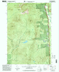
1995 Map of Chatham
USGS Topo · Published 2000About this map
White Mountain National Forest dominates this landscape along the New Hampshire-Maine border, where the steep peaks of the Baldface and Eastman mountains tower over narrow river valleys. In the mid-1990s, the small settlements of North Chatham and Chatham remained the primary outposts of human activity, clustered near the Cold River AMC Camp. The map documents a rugged recreational network, including the Circle Trail and Meader Mill Trail, which traverse ridges like Bicknell Ridge and lead to remote water bodies like Mountain Pond and Province Pond. The drainage patterns of the Wild River and East Branch Saco River dictate the local topography, while scattered cemeteries and gravel pits mark the modest footprint of permanent residency in this heavily forested mountain corridor.
Find a feature on this map
44 named features on this map. Tap any name to fly to it.
Don’t see what you’re looking for? This feature index may not catch every label — zoom into the map to look around manually.
Map Details
Editions of this 1995 Chatham Map
This is the sole edition of this map. No revisions or reprints were ever made.
Other maps of this area

1893 · Gorham
USGS Topo · 1:62,500

1894 · North Conway
USGS Topo · 1:62,500

1896 · North Conway
USGS Topo · 1:62,500

1896 · Gorham
USGS Topo · 1:62,500

1909 · Fryeburg
USGS Topo · 1:62,500

1911 · Fryeburg
USGS Topo · 1:62,500

1914 · Bethel
USGS Topo · 1:62,500

1937 · Gorham
USGS Topo · 1:48,000

1940 · Bethel
USGS Topo · 1:62,500

1941 · Bethel
USGS Topo · 1:62,500