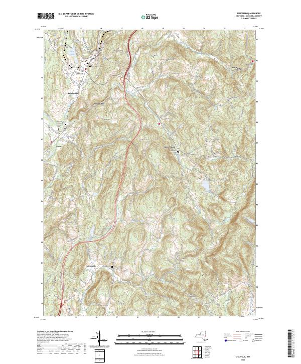
2023 Map of Chatham
USGS Topo · Published 2023About this map
Chatham and the surrounding Columbia County landscape are defined by a network of winding kills and creeks that have long shaped the region's industry and settlement patterns. The map documents the persistent agricultural and residential character of northern New York, where small hamlets like Buckleyville and Arnolds Mill sit alongside established crossroads. The topography is anchored by the prominent Kijk-Uit Mountain in the south, while several historic burying grounds, including the Chatham Rural Cem and Spencertown Cem, provide critical points of reference for local genealogy and land-use history.
Find a feature on this map
126 named features on this map. Tap any name to fly to it.
Don’t see what you’re looking for? This feature index may not catch every label — zoom into the map to look around manually.
Map Details
Editions of this 2023 Chatham Map
This is the sole edition of this map. No revisions or reprints were ever made.
Other maps of this area

1885 · Sheffield
USGS Topo · 1:62,500

1888 · Sheffield
USGS Topo · 1:62,500

1888 · Pittsfield
USGS Topo · 1:62,500

1890 · Pittsfield
USGS Topo · 1:62,500

1891 · Sheffield
USGS Topo · 1:62,500

1893 · Sheffield
USGS Topo · 1:62,500

1893 · Pittsfield
USGS Topo · 1:62,500

1894 · Pittsfield
USGS Topo · 1:62,500

1897 · Pittsfield
USGS Topo · 1:62,500

1897 · Sheffield
USGS Topo · 1:62,500