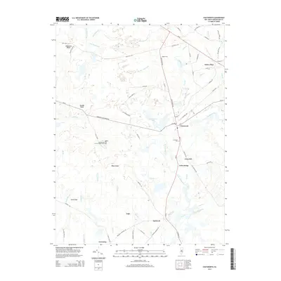
2014 Map of Chatsworth
USGS Topo · Published 2014About this map
Apple Pie Hill Forestry Lookout Tower stands as a prominent high point in this 2014 survey of the New Jersey Pine Barrens, overlooking a landscape defined by an intricate network of narrow cedar runs and swampy branches. The village of Chatsworth serves as the central hub, where Main St and Lake Ave meet near the shores of Chatsworth Lake. This area is characterized by scattered family-named settlements and historical sites like Jones Mill and Butlers Place, reflecting a long-standing pattern of dispersed residency in the region.
Find a feature on this map
77 named features on this map. Tap any name to fly to it.
Don’t see what you’re looking for? This feature index may not catch every label — zoom into the map to look around manually.
Map Details
Editions of this 2014 Chatsworth Map
This is the sole edition of this map. No revisions or reprints were ever made.
Other maps of this area

1884 · Whitings
USGS Topo · 1:62,500

1888 · Pemberton
USGS Topo · 1:62,500

1888 · Little Egg Harbor
USGS Topo · 1:62,500

1888 · Whitings
USGS Topo · 1:62,500

1890 · Mullica
USGS Topo · 1:62,500

1893 · Little Egg Harbor
USGS Topo · 1:62,500

1894 · Pemberton
USGS Topo · 1:62,500

1894 · Mullica
USGS Topo · 1:62,500

1898 · Pemberton
USGS Topo · 1:62,500

1898 · Mullica
USGS Topo · 1:62,500
Featured Places
- Tabernacle Township, NJ
- Washington Township, NJ
- Dukes Bridge, NJ
- Butlers Place, NJ
- Woodland Township, NJ