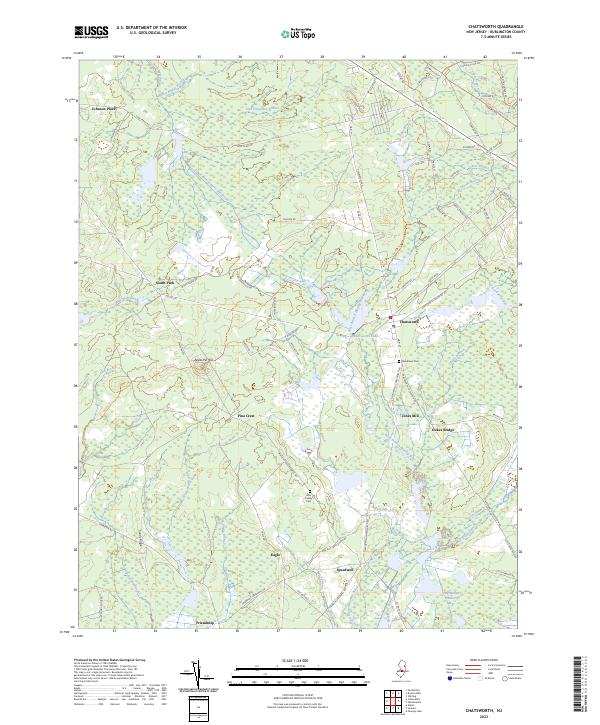
2023 Map of Chatsworth
USGS Topo · Published 2023About this map
The West Branch Wading River meanders through this landscape in Burlington County, anchoring a region defined by its wetland agriculture and small settlements. The map highlights the area's specialized economy with the Hog Wallow Cranberry Bogs near the southern boundary, a characteristic feature of the New Jersey Pinelands. Small communities like Chatsworth and Speedwell are connected by a network of historic routes, including the Batona Trl and White Horse Rd.
Find a feature on this map
82 named features on this map. Tap any name to fly to it.
Don’t see what you’re looking for? This feature index may not catch every label — zoom into the map to look around manually.
Map Details
Editions of this 2023 Chatsworth Map
This is the sole edition of this map. No revisions or reprints were ever made.
Other maps of this area

1884 · Whitings
USGS Topo · 1:62,500

1888 · Pemberton
USGS Topo · 1:62,500

1888 · Little Egg Harbor
USGS Topo · 1:62,500

1888 · Whitings
USGS Topo · 1:62,500

1890 · Mullica
USGS Topo · 1:62,500

1893 · Little Egg Harbor
USGS Topo · 1:62,500

1894 · Pemberton
USGS Topo · 1:62,500

1894 · Mullica
USGS Topo · 1:62,500

1898 · Pemberton
USGS Topo · 1:62,500

1898 · Mullica
USGS Topo · 1:62,500