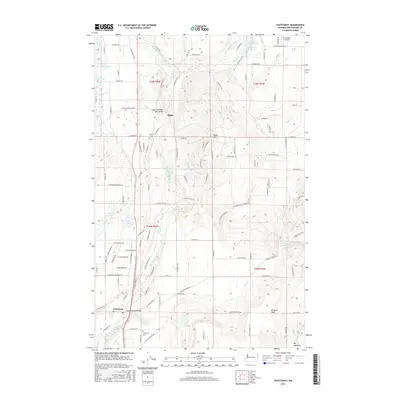
2017 Map of Chattaroy
USGS Topo · Published 2017About this map
The Little Spokane River carves a central path through this northern Spokane County landscape, linking the small communities of Milan and Chattaroy. This 2017 survey details a region defined by its water and high ground, from the elevated Orchard Bluff to the prominent Milan Hill. Local history is anchored by the Milan Cem and Chattaroy Cem, while the Deer Park-Milan Road Bridge and Chattaroy Road Bridge mark critical crossing points over the winding river. The surrounding terrain is dotted with several small water bodies, including Dead Mans Lake, Owens Lake, and Reflection Lake, illustrating the post-glacial geography of the Inland Northwest. Smaller settlements like Big Meadows and the drainage of Cottonwood Cr provide additional landmarks for those tracing family roots or the evolution of rural road networks in the area.
Find a feature on this map
107 named features on this map. Tap any name to fly to it.
Don’t see what you’re looking for? This feature index may not catch every label — zoom into the map to look around manually.
Map Details
Editions of this 2017 Chattaroy Map
This is the sole edition of this map. No revisions or reprints were ever made.
Other maps of this area

1901 · Spokane
USGS Topo · 1:125,000

1936 · Newport
USGS Topo · 1:96,000

1942 · Newport
USGS Topo · 1:125,000

1943 · Mt Spokane
USGS Topo · 1:62,500

1949 · Deer Park
USGS Topo · 1:62,500

1950 · Mt Spokane
USGS Topo · 1:62,500

1951 · Deer Park
USGS Topo · 1:62,500

1955 · Spokane
USGS Topo · 1:250,000

1958 · Spokane
USGS Topo · 1:250,000

1958 · Sandpoint
USGS Topo · 1:250,000