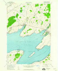
1958 Map of Chaumont
USGS Topo · Published 1960About this map
Chaumont and the surrounding shoreline of Lake Ontario define this coastal landscape, where the Chaumont River flows into Sawmill Bay. The map reveals a community deeply tied to its geography, with long, narrow landforms like Three Mile Point and Point Salubrious reaching into the water. Settlement patterns follow the jagged coast, from the inland farming plots near Rosiere to the developed waterfront at Three Mile Bay. Transportation is anchored by the Railroad and a network of named local routes like Old Town Springs Road and Carrying Place Road. Genealogists will find a wealth of family history markers, including Harris Cem, Wells Cem, and Point Salubrious Cem. The industrial and public character of the era is evident in the presence of a local Quarry, the High Sch in town, and the preserved lakeside at Long Point State Park.
Find a feature on this map
56 named features on this map. Tap any name to fly to it.
Don’t see what you’re looking for? This feature index may not catch every label — zoom into the map to look around manually.
Map Details
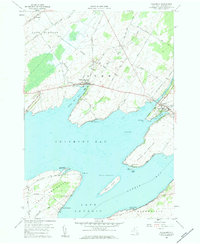
Editions of this 1958 Chaumont Map
2 editions found
Other maps of this area

1893 · Sackets Harbor
USGS Topo · 1:62,500

1895 · Sacketts Harbor
USGS Topo · 1:62,500

1895 · Stony Island
USGS Topo · 1:62,500

1895 · Cape Vincent
USGS Topo · 1:62,500

1900 · Clayton
USGS Topo · 1:62,500

1903 · Clayton
USGS Topo · 1:62,500

1942 · Cape Vincent North
USGS Topo · 1:31,680

1942 · Henderson Bay
USGS Topo · 1:31,680

1942 · Chaumont
USGS Topo · 1:31,680

1942 · Sawmill Bay
USGS Topo · 1:31,680