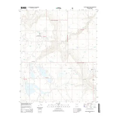
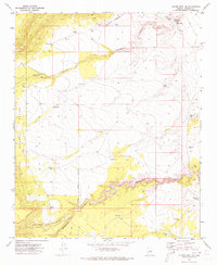
2014 Map of Chavez Mountain West
USGS Topo · Published 2014About this map
Coconino National Forest encompasses this high-altitude landscape, where volcanic features and water management strategies define the terrain. The presence of Chavez Mountain and the strategic Chavez Pass in the southeast suggest a historical corridor through the high country. Evidence of the region's reliance on seasonal and catchment water is visible in the numerous tanks and lakes, including Tremaine Lake, Long Lake, and Red Lake. The mapping of Canyon Diablo and Sawmill Wash underscores the drainage patterns that have shaped this portion of the forest. Land use is further illustrated by the inclusion of Lockwood Park and various family-named features like Tommie Tank and Lewis Tank, which indicate a history of local ranching and land management within the federal forest boundaries.
Find a feature on this map
39 named features on this map. Tap any name to fly to it.
Don’t see what you’re looking for? This feature index may not catch every label — zoom into the map to look around manually.
Map Details
Editions of this 2014 Chavez Mountain West Map
This is the sole edition of this map. No revisions or reprints were ever made.
Other maps of this area

1887 · Verde
USGS Topo · 1:250,000

1892 · Verde
USGS Topo · 1:250,000

1954 · Holbrook
USGS Topo · 1:250,000

1957 · Holbrook
USGS Topo · 1:250,000

1958 · Holbrook
USGS Topo · 1:250,000

1960 · Holbrook
USGS Topo · 1:250,000
1970 · Kinnikinick Lake
USGS Topo · 1:24,000
1970 · Turkey Mtn.
USGS Topo · 1:24,000
1970 · Jaycox Mtn.
USGS Topo · 1:24,000
1970 · Chavez Mtn NW
USGS Topo · 1:24,000