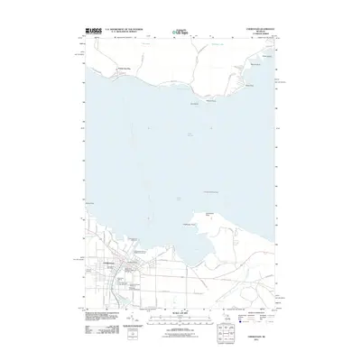
2011 Map of Cheboygan
USGS Topo · Published 2011About this map
The mouth of the Little Black River serves as the focal point for Cheboygan, where maritime activity and local infrastructure converge at the edge of Lake Huron. This 2011 survey documents a landscape defined by its relation to the water, featuring the prominent Bascule Bridge and several navigational aids including the Cheboygan Crib Lighthouse and the River Front Range Lighthouse. Beyond the harbor, the map captures the transition to Bois Blanc Island, where Pointe Aux Pins and Snake Island overlook the shipping lanes toward Fourteen Foot Shoal Light.
Find a feature on this map
70 named features on this map. Tap any name to fly to it.
Don’t see what you’re looking for? This feature index may not catch every label — zoom into the map to look around manually.
Map Details
Editions of this 2011 Cheboygan Map
This is the sole edition of this map. No revisions or reprints were ever made.
Other maps of this area

1955 · Cheboygan
USGS Topo · 1:250,000

1957 · Cheboygan
USGS Topo · 1:62,500

1957 · Mullett Lake
USGS Topo · 1:62,500

1958 · Cheboygan
USGS Topo · 1:250,000

1964 · Round Island
USGS Topo · 1:24,000

1964 · McRae Bay
USGS Topo · 1:24,000

1982 · Cordwood Point
USGS Topo · 1:25,000

1982 · Cheboygan
USGS Topo · 1:25,000

1982 · Point Nipigon
USGS Topo · 1:25,000

1982 · Aloha
USGS Topo · 1:25,000