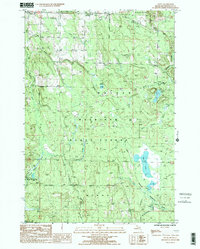
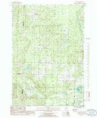
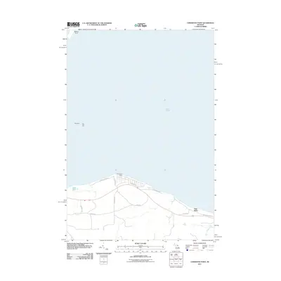
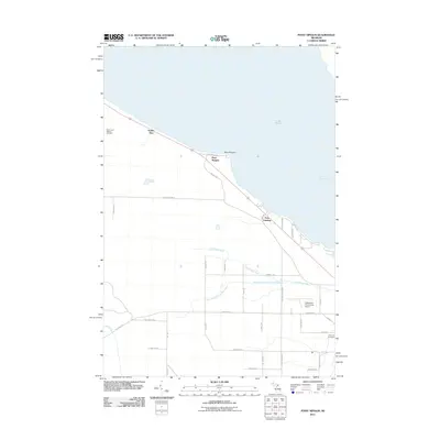
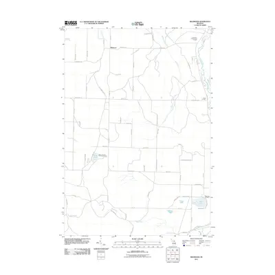
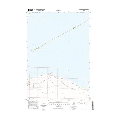
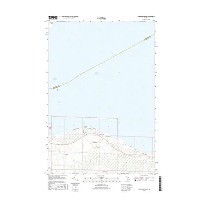
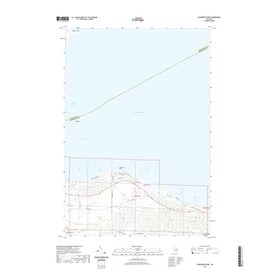
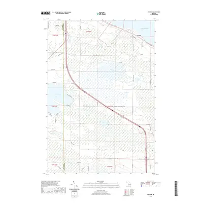
1982 Map of Cordwood Point
USGS Topo · Published 1983About this map
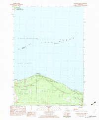
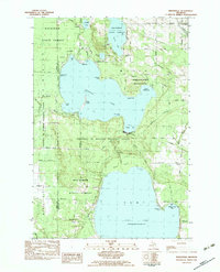
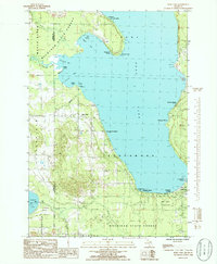
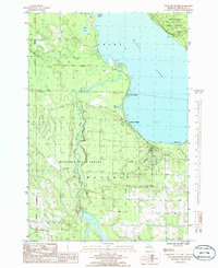
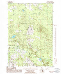
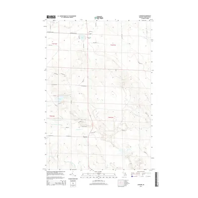
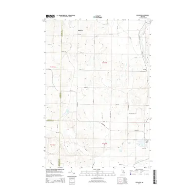
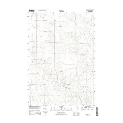
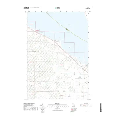
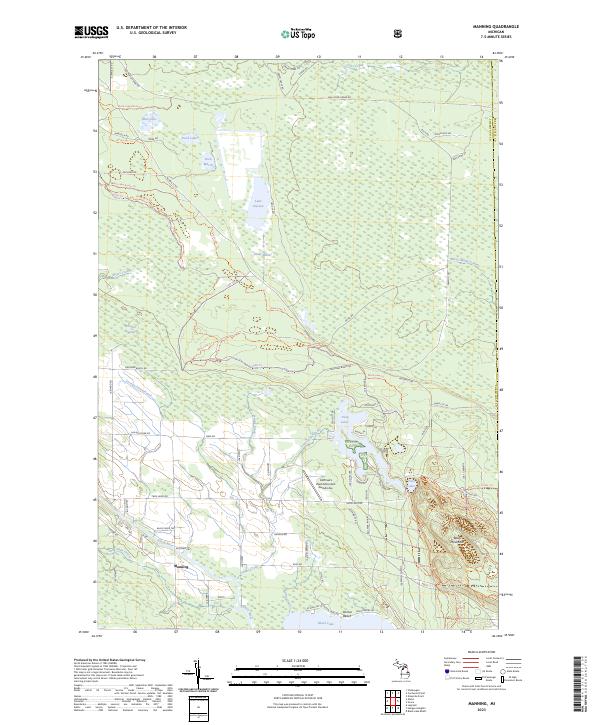
Mackinaw State Forest dominates this coastal landscape along the northern shores of Michigan's Lower Peninsula, where the Straits of Mackinaw meet Lake Huron. The map details the transition from the sandy reaches of Grass Bay and Grass Lake to the elevated terrain of the High Banks. A network of unpaved paths and local roads like Lakewood Drive and Mackinaw Straits Drive weave through the forest, serving remote cabins and the Radio Towers (WTOM). Across the South Channel, the southern tip of Bois Blanc Island is visible, featuring Walkers Point and the Coast Guard Chapel. This 1982 provisional edition captures a period of quiet recreation and conservation, illustrating the sparse settlement patterns and the preservation of the shoreline before modern expansion.
Find a feature on this map
23 named features on this map. Tap any name to fly to it.
Don’t see what you’re looking for? This feature index may not catch every label — zoom into the map to look around manually.
Map Details
Editions of this 1982 Cordwood Point Map
This is the sole edition of this map. No revisions or reprints were ever made.
Historical Maps of Benton Township Through Time
73 maps found
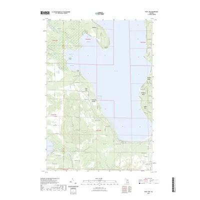
1957 Mullett Lake
Cheboygan County, MI
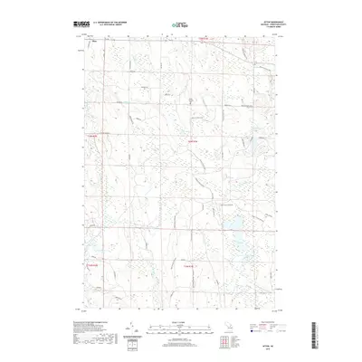
1982 Aloha
Cheboygan County, MI
1982 Cordwood Point
Cheboygan County, MI
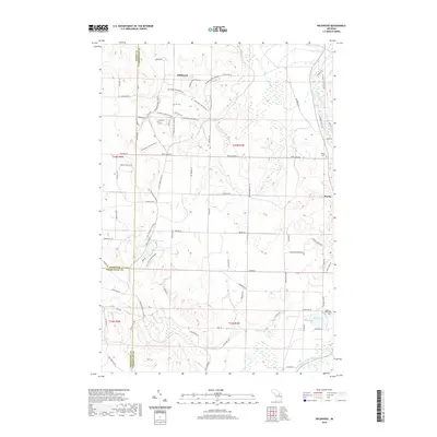
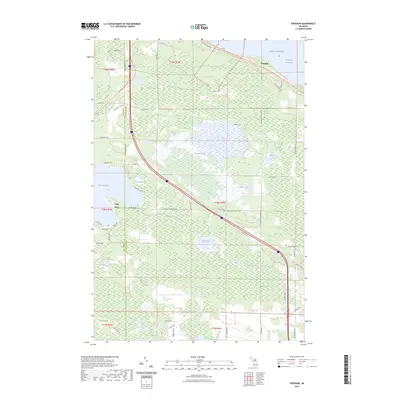
1982 Freedom
Cheboygan County, MI
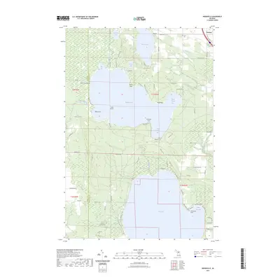
1982 Indianville
Cheboygan County, MI
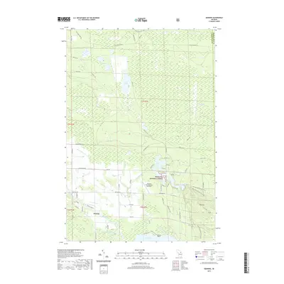
1982 Manning
Cheboygan County, MI
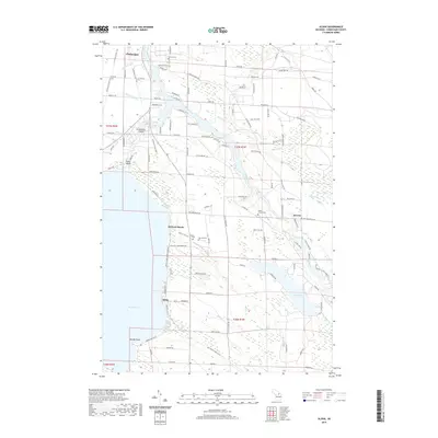
1982 Mullett Lake
Cheboygan County, MI
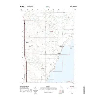
1982 Point Nipigon
Cheboygan County, MI
1986 Afton
Cheboygan County, MI
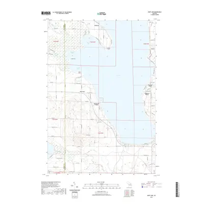
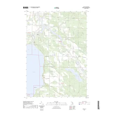
1986 Burt Lake
Cheboygan County, MI
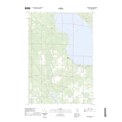
1986 Hangore Heights
Cheboygan County, MI
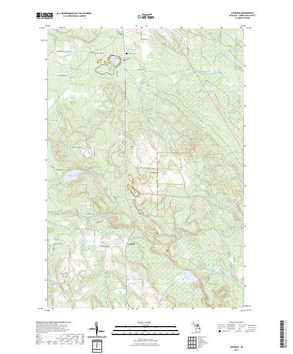
1986 Legrand
Cheboygan County, MI
1986 Wildwood
Cheboygan County, MI
2011 Afton
Cheboygan County, MI
2011 Aloha
Cheboygan County, MI
2011 Burt Lake
Cheboygan County, MI
2011 Cordwood Point
Cheboygan County, MI
2011 Freedom
Cheboygan County, MI
2011 Hangore Heights
Cheboygan County, MI
2011 Indianville
Cheboygan County, MI
2011 Legrand
Cheboygan County, MI
2011 Manning
Cheboygan County, MI
2011 Mullett Lake
Cheboygan County, MI
2011 Point Nipigon
Cheboygan County, MI
2011 Wildwood
Cheboygan County, MI
2014 Afton
Cheboygan County, MI
2014 Aloha
Cheboygan County, MI
2014 Burt Lake
Cheboygan County, MI
2014 Cordwood Point
Cheboygan County, MI
2014 Freedom
Cheboygan County, MI
2014 Hangore Heights
Cheboygan County, MI
2014 Indianville
Cheboygan County, MI
2014 Legrand
Cheboygan County, MI
2014 Manning
Cheboygan County, MI
2014 Mullett Lake
Cheboygan County, MI
2014 Point Nipigon
Cheboygan County, MI
2014 Wildwood
Cheboygan County, MI
2017 Afton
Cheboygan County, MI
2017 Aloha
Cheboygan County, MI
2017 Burt Lake
Cheboygan County, MI
2017 Cordwood Point
Cheboygan County, MI
2017 Freedom
Cheboygan County, MI
2017 Hangore Heights
Cheboygan County, MI
2017 Indianville
Cheboygan County, MI
2017 Legrand
Cheboygan County, MI

2017 Manning
Cheboygan County, MI
2017 Mullett Lake
Cheboygan County, MI
2017 Point Nipigon
Cheboygan County, MI
2017 Wildwood
Cheboygan County, MI
2019 Afton
Cheboygan County, MI
2019 Aloha
Cheboygan County, MI
2019 Burt Lake
Cheboygan County, MI
2019 Cordwood Point
Cheboygan County, MI
2019 Freedom
Cheboygan County, MI
2019 Hangore Heights
Cheboygan County, MI
2019 Indianville
Cheboygan County, MI
2019 Legrand
Cheboygan County, MI
2019 Manning
Cheboygan County, MI
2019 Mullett Lake
Cheboygan County, MI
2019 Point Nipigon
Cheboygan County, MI
2019 Wildwood
Cheboygan County, MI
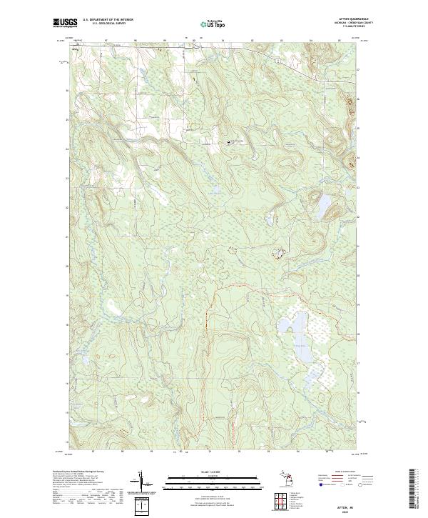
2023 Afton
Cheboygan County, MI
2023 Aloha
Cheboygan County, MI
2023 Burt Lake
Cheboygan County, MI
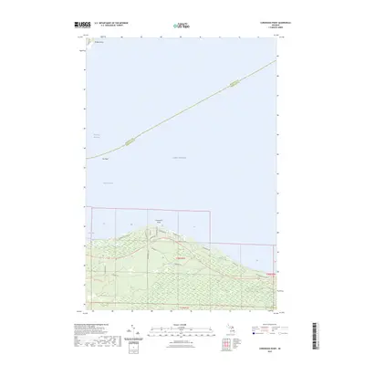
2023 Cordwood Point
Cheboygan County, MI
2023 Freedom
Cheboygan County, MI
2023 Hangore Heights
Cheboygan County, MI
2023 Indianville
Cheboygan County, MI
2023 Legrand
Cheboygan County, MI
2023 Manning
Cheboygan County, MI
2023 Mullett Lake
Cheboygan County, MI
2023 Point Nipigon
Cheboygan County, MI
2023 Wildwood
Cheboygan County, MI
Featured Locations
- Cheboygan County, MI
- Bearinger Township, MI
- Benton Township, MI
- Bois Blanc Township, MI
- High Banks, Benton Township