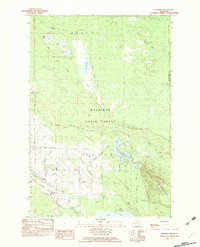
1982 Map of Manning
USGS Topo · Published 1983About this map
Manning stands at a rural crossroads along the Black River in this early 1980s look at northern Michigan. This landscape is defined by its transition from the dense wetlands of the Alverno Swamp and Linsey Marsh to the elevated terrain of Black Mountain in the southeast. Local life is anchored by the Black River Ch and a nearby Townhall, while the river itself serves as a major geographical artery flowing toward Black Lake.
Find a feature on this map
47 named features on this map. Tap any name to fly to it.
Don’t see what you’re looking for? This feature index may not catch every label — zoom into the map to look around manually.
Map Details
Editions of this 1982 Manning Map
This is the sole edition of this map. No revisions or reprints were ever made.
Other maps of this area

1955 · Cheboygan
USGS Topo · 1:250,000

1957 · Tower
USGS Topo · 1:62,500

1957 · Cheboygan
USGS Topo · 1:62,500

1957 · Onaway
USGS Topo · 1:62,500

1958 · Cheboygan
USGS Topo · 1:250,000

1958 · Grace
USGS Topo · 1:62,500

1982 · Petoskey
USGS Topo · 1:100,000

1982 · Cordwood Point
USGS Topo · 1:25,000

1982 · Cheboygan
USGS Topo · 1:25,000

1982 · Grace
USGS Topo · 1:24,000