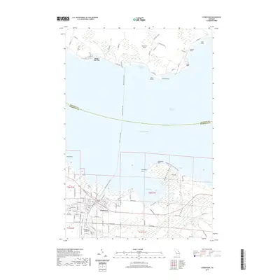
2019 Map of Cheboygan
USGS Topo · Published 2019About this map
Cheboygan serves as a vital gateway between the northern Lower Peninsula and the Straits of Mackinac, anchored by the downtown presence of the Cheboygan County Building and the landmark Bascule Bridge spanning the Cheboygan River. The landscape is defined by the heavy maritime traffic of the South Channel, with the Bois Blanc Island Ferry route connecting the mainland to the northern shore of Bois Blanc Island. Along this northern coast, the community of Pointe Aux Pins sits near Waterway Harbor, surrounded by numerous points and bays such as Packard Point and Snake Island. To the east of the city, Cheboygan State Park preserves the shoreline around Duncan Bay and Lighthouse Point, while genealogists can find historical burial records at Pine Hill Cem and its adjacent Pine Hill Cem Annex near the Little Black River.
Find a feature on this map
120 named features on this map. Tap any name to fly to it.
Don’t see what you’re looking for? This feature index may not catch every label — zoom into the map to look around manually.
Map Details
Editions of this 2019 Cheboygan Map
This is the sole edition of this map. No revisions or reprints were ever made.
Other maps of this area

1955 · Cheboygan
USGS Topo · 1:250,000

1957 · Cheboygan
USGS Topo · 1:62,500

1957 · Mullett Lake
USGS Topo · 1:62,500

1958 · Cheboygan
USGS Topo · 1:250,000

1964 · Round Island
USGS Topo · 1:24,000

1964 · McRae Bay
USGS Topo · 1:24,000

1982 · Cordwood Point
USGS Topo · 1:25,000

1982 · Cheboygan
USGS Topo · 1:25,000

1982 · Point Nipigon
USGS Topo · 1:25,000

1982 · Aloha
USGS Topo · 1:25,000