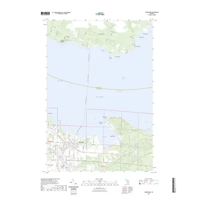
2023 Map of Cheboygan
USGS Topo · Published 2023About this map
Cheboygan serves as a critical nautical gateway where the Cheboygan River meets Lake Huron and the Straits of Mackinac. This maritime environment is defined by the heavy traffic of the Bois Blanc Island Ferry, which connects the mainland to the settlement of Pointe Aux Pins and the residential stretches along W Huron Dr. On the island, the Woodland Glade Cem sits near the northern shoreline, while the mainland town contains the Cheboygan County Building and established local sites like Pine Hill Cem. East of the river mouth, Duncan Bay is flanked by the protected lands of Cheboygan State Park Green Trl, leading toward the distinct coastal features of Lighthouse Point and Cheboygan Point. The landscape reflects a legacy of lake-faring trade and modern conservation.
Find a feature on this map
111 named features on this map. Tap any name to fly to it.
Don’t see what you’re looking for? This feature index may not catch every label — zoom into the map to look around manually.
Map Details
Editions of this 2023 Cheboygan Map
This is the sole edition of this map. No revisions or reprints were ever made.
Other maps of this area

1955 · Cheboygan
USGS Topo · 1:250,000

1957 · Cheboygan
USGS Topo · 1:62,500

1957 · Mullett Lake
USGS Topo · 1:62,500

1958 · Cheboygan
USGS Topo · 1:250,000

1964 · Round Island
USGS Topo · 1:24,000

1964 · McRae Bay
USGS Topo · 1:24,000

1982 · Cordwood Point
USGS Topo · 1:25,000

1982 · Cheboygan
USGS Topo · 1:25,000

1982 · Point Nipigon
USGS Topo · 1:25,000

1982 · Aloha
USGS Topo · 1:25,000