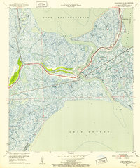
1951 Map of Chef Menteur
USGS Topo · Published 1952About this map
Chef Menteur Pass serves as a critical hydrologic artery in this coastal landscape, connecting the waters of Lake Pontchartrain and Lake Borgne. The 1951 revision shows a geography defined by intricate wetland networks, where major infrastructure like the Louisville and Nashville railroad and the Nashville and New Orleans Road cross the marsh toward the city. The presence of Fort Macomb (Ruins) at the pass offers a tangible link to 19th-century coastal defense, standing at a strategic junction where the Intracoastal Waterway intersects the natural bayous. This area of Orleans Parish is dominated by names like Bayou Sauvage and Bayou Gentilly, reflecting a complex environment of ridges and swamp before the extensive mid-century developments in the East New Orleans area.
Find a feature on this map
34 named features on this map. Tap any name to fly to it.
Don’t see what you’re looking for? This feature index may not catch every label — zoom into the map to look around manually.
Map Details
Editions of this 1951 Chef Menteur Map
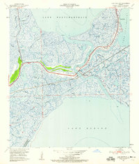
2 editions found
Other maps of this area

1892 · Chef Menteur
USGS Topo · 1:62,500

1892 · St. Bernard
USGS Topo · 1:62,500

1893 · Rigolets
USGS Topo · 1:62,500

1893 · Shell Beach
USGS Topo · 1:62,500

1936 · North Shore
USGS Topo · 1:31,680

1936 · South Point
USGS Topo · 1:31,680

1936 · Chef Menteur
USGS Topo · 1:62,500

1936 · Rigolets
USGS Topo · 1:62,500

1937 · Chef Menteur
USGS Topo · 1:31,680

1938 · Little Woods
USGS Topo · 1:31,680
Featured Places
- New Orleans, LA
- Greens Ditch, New Orleans
- Venetian Isles, New Orleans
- Chef Menteur, New Orleans
- Orleans Parish, LA