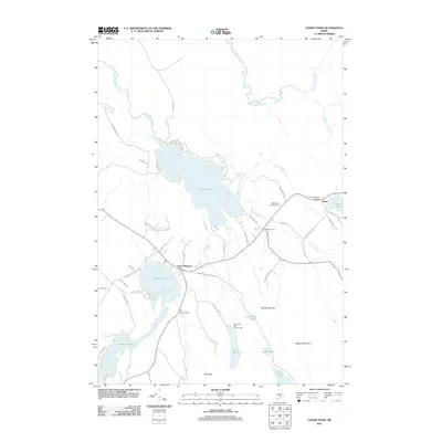
2011 Map of Chemo Pond
USGS Topo · Published 2011About this map
Chemo Pond and Holbrook Pond dominate the central landscape of this Penobscot County region, where the water-rich terrain of southern Maine meets the rising elevations of Pisgah Mountain and Blackcap. The primary settlements of East Eddington and Clifton are connected by a network of local roads such as Bangor Water Works Rd and Getchell Rd. This map captures a balance of year-round communities and recreational history, featuring the Roosevelt Boy Scout Camp on the shores of Snowshoe Pond and the Parks Pond Campground. Genealogists and local researchers will find the locations of Pine Tree Cemetery and Mount Pleasant Cemetery clearly marked, alongside various family-named roads like Merrill Rd and Clewley Hill Rd, which trace the lines of historical land ownership and residential development in this rural corridor.
Find a feature on this map
59 named features on this map. Tap any name to fly to it.
Don’t see what you’re looking for? This feature index may not catch every label — zoom into the map to look around manually.
Map Details
Editions of this 2011 Chemo Pond Map
This is the sole edition of this map. No revisions or reprints were ever made.
Other maps of this area

1900 · Orland
USGS Topo · 1:62,500

1902 · Orono
USGS Topo · 1:62,500

1911 · Ellsworth
USGS Topo · 1:62,500

1929 · Great Pond
USGS Topo · 1:48,000

1932 · Great Pond
USGS Topo · 1:62,500

1940 · Ellsworth
USGS Topo · 1:62,500

1942 · Orland
USGS Topo · 1:62,500

1942 · Ellsworth
USGS Topo · 1:62,500

1944 · Orono
USGS Topo · 1:62,500

1946 · Orono
USGS Topo · 1:62,500