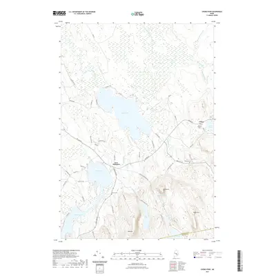
2021 Map of Chemo Pond
USGS Topo · Published 2021About this map
Chemo Pond and its extensive surrounding wetlands, including the large Chemo Bog, dominate this area of Penobscot County. The village of East Eddington serves as a local hub near Davis Pond, while Clifton sits further east along the Airline Rd corridor. This roadway, a key eastern Maine artery, passes by several local landmarks including Mount Pleasant Cem and Maplewood Cem.
Find a feature on this map
60 named features on this map. Tap any name to fly to it.
Don’t see what you’re looking for? This feature index may not catch every label — zoom into the map to look around manually.
Map Details
Editions of this 2021 Chemo Pond Map
This is the sole edition of this map. No revisions or reprints were ever made.
Other maps of this area

1900 · Orland
USGS Topo · 1:62,500

1902 · Orono
USGS Topo · 1:62,500

1911 · Ellsworth
USGS Topo · 1:62,500

1929 · Great Pond
USGS Topo · 1:48,000

1932 · Great Pond
USGS Topo · 1:62,500

1940 · Ellsworth
USGS Topo · 1:62,500

1942 · Orland
USGS Topo · 1:62,500

1942 · Ellsworth
USGS Topo · 1:62,500

1944 · Orono
USGS Topo · 1:62,500

1946 · Orono
USGS Topo · 1:62,500