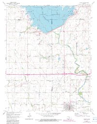
1964 Map of Cheney
USGS Topo · Published 1983About this map
Cheney serves as the primary hub in this Kansas landscape, where the Atchison Topeka and Santa Fe railroad corridor runs parallel to the southern edge of town near the Fairground. The map documents a period of significant hydraulic transition, dominated by the northern expanse of the Cheney Reservoir and the Cheney State Park, which have altered the original course of the North Fork Ninnescah River. To the west, the rural settlement of Mt Vernon is anchored by the Mt Vernon Cem, while the industrial character of the region is evident in the Casley Gas and Oil Field and numerous scattered Oil Wells. The southern half of the sheet reveals a landscape of high-energy infrastructure, including a prominent Pipeline and the private airstrip at Bartholomew Field. Local history is preserved through established landmarks such as the Cheney Cem and the small Trailer Park near the municipal boundary.
Find a feature on this map
33 named features on this map. Tap any name to fly to it.
Don’t see what you’re looking for? This feature index may not catch every label — zoom into the map to look around manually.
Map Details
Editions of this 1964 Cheney Map
2 editions found
Other maps of this area

1889 · Cheney
USGS Topo · 1:125,000

1891 · Cheney
USGS Topo · 1:125,000

1901 · Cheney
USGS Topo · 1:125,000

1955 · Wichita
USGS Topo · 1:250,000

1958 · Wichita
USGS Topo · 1:250,000

1959 · Mount Hope
USGS Topo · 1:24,000

1964 · Cheney
USGS Topo · 1:24,000

1965 · Garden Plain
USGS Topo · 1:24,000

1965 · Cheney SE
USGS Topo · 1:24,000
1965 · Waterloo
USGS Topo · 1:24,000