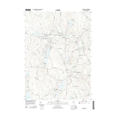
2015 Map of Chepachet
USGS Topo · Published 2015About this map
Harrisville and Pascoag anchor a landscape defined by its industrial waterpower history along the Clear River and Branch River. This 2015 survey details a dense network of mill ponds and reservoirs, including the Harrisville Mill Pond, Shingle Mill Pond, and the expansive Pascoag Reservoir. The village of Chepachet serves as a historic crossroads in the southern portion of the map, where the Chepachet River winds through terrain marked by prominent heights like Acote Hill and Durfee Hill. Genealogists will find significant detail in the placement of the Chepachet Cem, Steere Cem, and Irons Cem, alongside numerous family-named landmarks like Tourtellotte Hill and Cooper Hill. The map illustrates the persistent settlement patterns of northern Rhode Island, where small mill villages like Graniteville, Bridgeton, and Mapleville remain distinct clusters connected by historic routes like the Putnam Pike and Douglas Pike.
Find a feature on this map
99 named features on this map. Tap any name to fly to it.
Don’t see what you’re looking for? This feature index may not catch every label — zoom into the map to look around manually.
Map Details
Editions of this 2015 Chepachet Map
This is the sole edition of this map. No revisions or reprints were ever made.
Other maps of this area

1886 · Blackstone
USGS Topo · 1:62,500

1889 · Blackstone
USGS Topo · 1:62,500

1889 · Webster
USGS Topo · 1:62,500

1889 · Putnam
USGS Topo · 1:62,500

1889 · Burrillville
USGS Topo · 1:62,500

1892 · Webster
USGS Topo · 1:62,500

1893 · Putnam
USGS Topo · 1:62,500

1893 · Blackstone
USGS Topo · 1:62,500

1894 · Burrillville
USGS Topo · 1:62,500

1900 · Blackstone
USGS Topo · 1:62,500