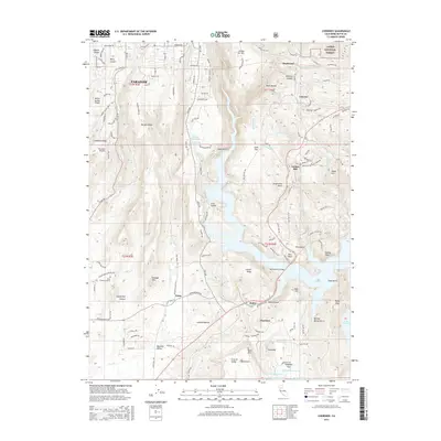
2015 Map of Cherokee
USGS Topo · Published 2015About this map
Paradise and the surrounding foothill communities of Butte County are documented here as they appeared in 2015, just prior to major landscape-altering events in the region. The map illustrates a complex interface between residential development and the steep, drainage-carved terrain of the Sierra Nevada foothills. The West Branch of Lake Oroville dominates the central and eastern portions, where the West Branch Bridge spans the water near Yankee Hill.
Find a feature on this map
140 named features on this map. Tap any name to fly to it.
Don’t see what you’re looking for? This feature index may not catch every label — zoom into the map to look around manually.
Map Details
Editions of this 2015 Cherokee Map
This is the sole edition of this map. No revisions or reprints were ever made.
Other maps of this area

1888 · Bidwell Bar
USGS Topo · 1:125,000

1891 · Bidwell Bar
USGS Topo · 1:125,000

1891 · Chico
USGS Topo · 1:125,000

1893 · Chico
USGS Topo · 1:125,000

1893 · Bidwell Bar
USGS Topo · 1:125,000

1895 · Bidwell Bar
USGS Topo · 1:125,000

1895 · Chico
USGS Topo · 1:125,000

1897 · Bidwell Bar
USGS Topo · 1:125,000

1912 · Dry Creek
USGS Topo · 1:31,680

1912 · Oroville
USGS Topo · 1:31,680