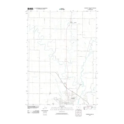
2010 Map of Cherokee North
USGS Topo · Published 2010About this map
The Little Sioux River meanders through the eastern section of this landscape, its path defining the topography north of Cherokee. This survey documents a transition from the structured street grid of the city into the expansive agricultural sections of Cherokee County, where the village of Larrabee serves as a northern anchor. The area is notable for its concentration of burial grounds, including the historic Oak Hill Cemetery and the Mental Health Institute Cemetery, providing specific data points for local genealogy.
Find a feature on this map
32 named features on this map. Tap any name to fly to it.
Don’t see what you’re looking for? This feature index may not catch every label — zoom into the map to look around manually.
Map Details
Editions of this 2010 Cherokee North Map
This is the sole edition of this map. No revisions or reprints were ever made.
Other maps of this area

1954 · Fort Dodge
USGS Topo · 1:250,000

1957 · Fort Dodge
USGS Topo · 1:250,000

1958 · Fort Dodge
USGS Topo · 1:250,000

1969 · Aurelia
USGS Topo · 1:24,000

1969 · Cleghorn
USGS Topo · 1:24,000

1969 · Cherokee South
USGS Topo · 1:24,000
1969 · Quimby
USGS Topo · 1:24,000

1971 · Peterson SW
USGS Topo · 1:24,000
1971 · Paullina
USGS Topo · 1:24,000
1971 · Sutherland West
USGS Topo · 1:24,000