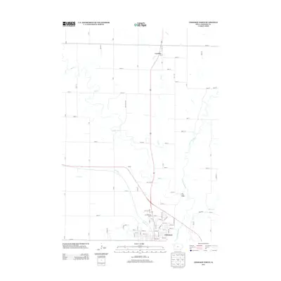
2013 Map of Cherokee North
USGS Topo · Published 2013About this map
Cherokee and Larrabee anchor this landscape along the winding path of the Little Sioux River in northwest Iowa. The terrain is defined by a dense network of watercourses including Mill Cr, Gray Cr, and Railroad Cr, which cut through the agricultural grid established by an extensive system of numbered section roads. Local transit patterns are clearly visible, from the established crossing at Mill Creek Bridge to the radiating streets of northern Cherokee, such as E Bluff St and Walnut St. The map reflects a meticulously planned rural infrastructure where primary thoroughfares like Oak Rd and Valley Rd connect the concentrated residential blocks of the townships to the surrounding farms and creek valleys. This 2013 record details the modern footprint of these historic prairie settlements before continued expansion altered the municipal boundaries.
Find a feature on this map
69 named features on this map. Tap any name to fly to it.
Don’t see what you’re looking for? This feature index may not catch every label — zoom into the map to look around manually.
Map Details
Editions of this 2013 Cherokee North Map
This is the sole edition of this map. No revisions or reprints were ever made.
Other maps of this area

1954 · Fort Dodge
USGS Topo · 1:250,000

1957 · Fort Dodge
USGS Topo · 1:250,000

1958 · Fort Dodge
USGS Topo · 1:250,000

1969 · Aurelia
USGS Topo · 1:24,000

1969 · Cleghorn
USGS Topo · 1:24,000

1969 · Cherokee South
USGS Topo · 1:24,000
1969 · Quimby
USGS Topo · 1:24,000

1971 · Peterson SW
USGS Topo · 1:24,000
1971 · Paullina
USGS Topo · 1:24,000
1971 · Sutherland West
USGS Topo · 1:24,000