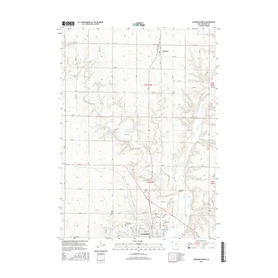
2015 Map of Cherokee North
USGS Topo · Published 2015About this map
The Little Sioux River carves a winding path through this Iowa landscape, defining the topography north of Cherokee. This 2015 record shows the transition from the town’s northern residential streets, such as W Bluff St and Sumner St, into the expansive agricultural sections of Cherokee County. The area is notable for its concentration of memorial sites, including Mount Calvary Cem, Oak Hill Cem, and the uniquely designated Mental Health Institute Cem.
Find a feature on this map
46 named features on this map. Tap any name to fly to it.
Don’t see what you’re looking for? This feature index may not catch every label — zoom into the map to look around manually.
Map Details
Editions of this 2015 Cherokee North Map
This is the sole edition of this map. No revisions or reprints were ever made.
Other maps of this area

1954 · Fort Dodge
USGS Topo · 1:250,000

1957 · Fort Dodge
USGS Topo · 1:250,000

1958 · Fort Dodge
USGS Topo · 1:250,000

1969 · Aurelia
USGS Topo · 1:24,000

1969 · Cleghorn
USGS Topo · 1:24,000

1969 · Cherokee South
USGS Topo · 1:24,000
1969 · Quimby
USGS Topo · 1:24,000

1971 · Peterson SW
USGS Topo · 1:24,000
1971 · Paullina
USGS Topo · 1:24,000
1971 · Sutherland West
USGS Topo · 1:24,000