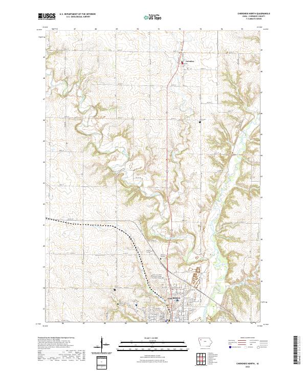
2022 Map of Cherokee North
USGS Topo · Published 2022About this map
The Little Sioux River meanders through the southern half of this quadrangle, shaping the development of the city of Cherokee and the surrounding agricultural landscape. As the county seat, Cherokee is defined by a traditional street grid housing the Cherokee County Courthouse and the Western Iowa Tech Community College Cherokee Campus. North of the city, the land rises into a systematic grid of section roads punctuated by the small settlement of Larrabee and several family-named landmarks and cemeteries. The drainage patterns of Mill Creek and Gray Cr create a varied topography that contrasts with the upland farm plots. This modern topographic record captures the enduring intersection of Iowa’s river-valley industry and its deep-rooted rural infrastructure, from the Indian Street Trl near the riverbanks to the high points at Memory Gardens.
Find a feature on this map
47 named features on this map. Tap any name to fly to it.
Don’t see what you’re looking for? This feature index may not catch every label — zoom into the map to look around manually.
Map Details
Editions of this 2022 Cherokee North Map
This is the sole edition of this map. No revisions or reprints were ever made.
Other maps of this area

1954 · Fort Dodge
USGS Topo · 1:250,000

1957 · Fort Dodge
USGS Topo · 1:250,000

1958 · Fort Dodge
USGS Topo · 1:250,000

1969 · Aurelia
USGS Topo · 1:24,000

1969 · Cleghorn
USGS Topo · 1:24,000

1969 · Cherokee South
USGS Topo · 1:24,000
1969 · Quimby
USGS Topo · 1:24,000

1971 · Peterson SW
USGS Topo · 1:24,000
1971 · Paullina
USGS Topo · 1:24,000
1971 · Sutherland West
USGS Topo · 1:24,000